 |
Trip Date — May 28-31, 2005
The continuation page…
On Sunday, I started riding south and stopped in at the Columbia Icefields where I took a tour of the glaciers. The views are incredible though it's the size of the icefield that is so overpowering.
If you travel to this area, make sure that you stop at the Icefield Center and take the glacier tour run by Brewster. After riding a bus to the edge of the glacier, you then transfer to a vehicle that’s been specially designed to travel on glaciers (silly me didn’t take pictures of it!). The “glacier bus” travels down the lateral morraine and then drives across the glacier to a location just a few hundred yards from the head of the glacier.
 |
||
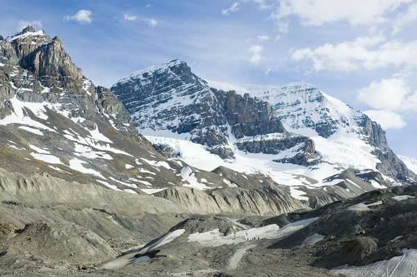
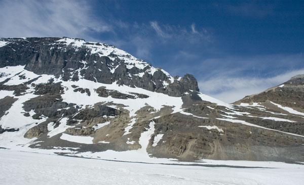
A tiny corner of the Athabasca glacier in the Columbia Icefields |
|
The picture above shows one part of the Athabasca glacier. The scale of the glacier is deceptive. If you view one of the larger pictures in the links above and look carefully at the base of the picture you see that the little dots on the snowfield are actually people!
 |
 |
 |
|
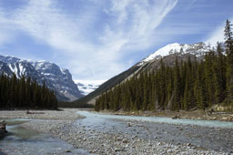
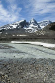
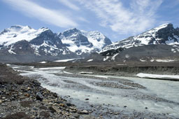
One of many glacial streams fed by the Athabasca glacier |
(Medium, Large, Extra Large) |
A glacial stream within half a mile of the glacier |
The glaciers in the Icefield continue to melt as they have since man first recorded their location in 1849. Most of the loss of glacial mass runs off as rivers. The shots above show the rivers running north from the front of the glacier. The water in these photos will run into the Artic Ocean.
 |
||
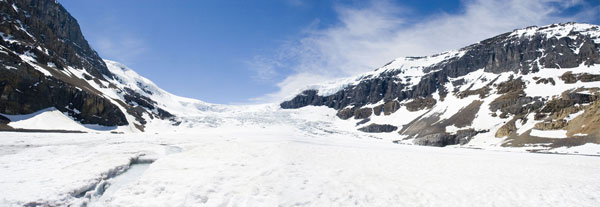
A panoramic view of the western end of the glacier. |
|
The photo above shows the head of the Athabasca glacier where it is fed by the Columbia Icefields. The glacier at this point is about 1,000' deep. This is a panoramic shot.
 |
||
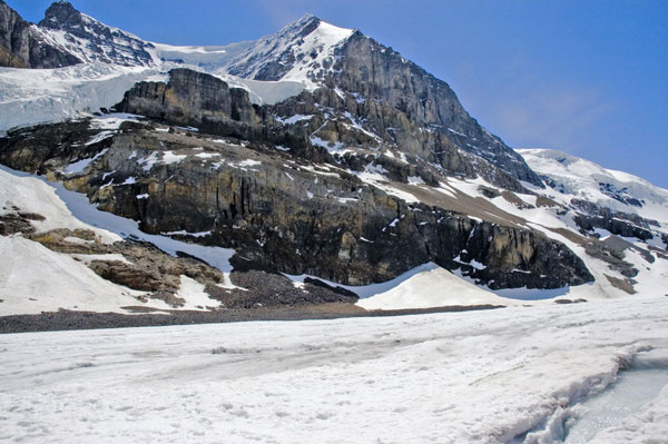
The left side of the mouth of the glacier. |
|
This picture shows the left side of the mouth of the glacier. The stream in the lower right corner of this photo is the same stream in the lower left side of the previous photo. The rocks show here looked to be a couple of hundred feet high.
 |
||
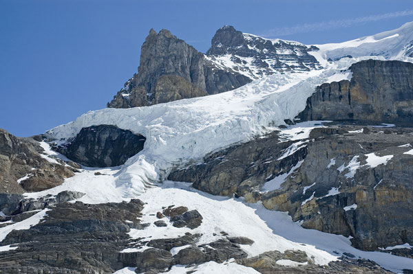
A feeder glacier to the Athabasca. |
|
Further off to the left (now on the south side of the glacier) this is a “feeder glacier”. I assume that it joins the Athabasca and it has its own supply of ice from the Icefieds which lie behind it.
 |
||
The right side of the glacier near Icefields. |
|
Further off to the right of the mouth. The rock walls shown here are a few hundred feet high.
(Pictures will be uploaded later…)
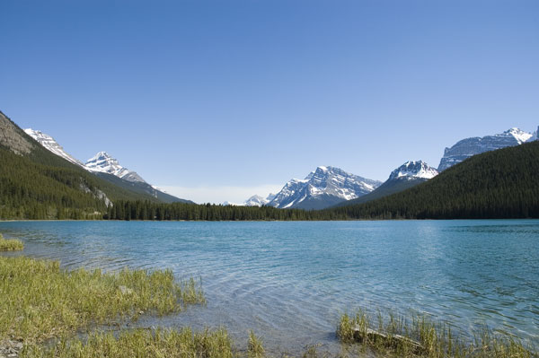
My next stop was to find a lake that I visited back in 2001 but whose name I had forgotten. The water in the lake, Lake Peyto, is a unique blue, a combination of blue and turquoise and it’s a unique, rich, almost iridescent color.
On Monday morning, I got up at 6 and headed up to Lake Louise, one of the most famous spots in Banff. The lake has the same color as Lake Peyto. It was a beautiful, calm scene in the morning light.
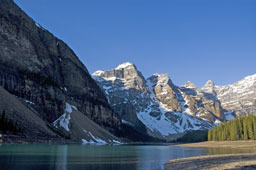
Morraine Lake, below, shares the deep blue coloring of Lakes Louise and Peyto.
 |
|||
Morraine Lake |
|
On the way back to the hotel in Banff, I saw a cow moose off the side of the road. I had to loop back around to get some pix of her. Even though the Gold Wing is very quiet, she didn’t care to stay in my presence so I was lucky to get the pictures I got (while I was walking, in fact!)
After checking out of the hotel, it was time to head home. I rode west through the Rockies, past the town of Radium Hot Springs (didn’t stop for a dip), and then turned south, entering the US in northern Idaho. I stopped Pasco, Washington for the night.
I woke up on Tuesday morning ready to finish the trip back to Folsom. There was a strange sound outside — wind. Not just breezy but windy, maybe 20 knots steady and gusting to 30 knots or more. Not pleasant to ride in and a real challenge on a 900 pound motorcycle.
I took the interstate which follows the Columbia river all the way to Portland. I haven’t see a large river in quite a few years so I was very impressed by the Columbia. Dotted with hydroelectric dams, the Columbia is quite a sight.
And then there was rain in Oregon (“And your point is…?”) It drizzled for hours, starting east of Portland. As I trundled south on the highway, the clouds seemed like they would never break up.
On the south side of the mountains between Oregon and California, the sun came out and I had a great view of Mt. Shasta and the west side of the Sierras. The ride toward and around Sacramento was, as I hoped it would be, uneventful and I ended up home, safe and sound, at about 10 o’clock at night, showing 3,250 miles on the GPS.
It was a long ride for a short stay in the mountains but I saw some beautiful countryside along the way and enjoyed every minute of my trip.
Click here for more pictures and info about the start of my trip to Jasper..