 |
 |
 |
Trip Date — January 29, 2005
Not really sure how this adventure started but I do know that I got the idea to ride to Volcanoville, CA from one of the articles on the Pashnit website.
As best I could tell, Volcanoville was an abandoned town nestled in the foothills of the Sierras and the roads that lead to it (careful, big file) looked excellent for motorcycle riding.
The winter of 2004 has not been good weather for motorcycles here in Northern California, so I was pleasantly surprised when the skies were blue and the air was crisp on the morning of January 29, 2005, the last Saturday of the month.
Starting my home in Folsom, about 25 miles east of Sacramento, I headed east on Route 50 toward Placerville. Route 49 intersects with Route 50 right in the center of Placerville so, after waiting (wading?) through the congestion of the intersection, I turned north on route 49. The intersection of 49 and 193 is right on the edge of the built up area of Placerville and the intersection is “without fanfare” - 193 is a drop off on the right hand side of 49. There are a lot of nice roads in the Placerville area but 193 was new to me.
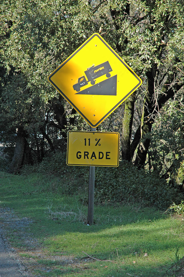
I got a chuckle when I saw this sign (M, L, XL) – I don’t recall ever seeing a sign for an 11% grade. I lived in or near the Rockies for almost 10 years and didn’t know much about the Sierras when I moved here three years ago. Take my word for it, they are a formidable mountain range, even here in the foothills.
Soon after got onto 193, I got a cheap lesson about riding my Gold Wing and taking pictures. More specifically about taking photographs on roads on steep hills. Be careful that your motorcycle doesn’t roll off the side stand while you’re taking a picture!
When I parked to take this picture (M, L, XL), I parked the Wing in what I thought would be a safe position. Since I was stopping “for just a minute” to take a picture, I thought it would be safe to the engine running. As I approached my bike after taking a few pix, I thought “Damn, it looks like it’s moving.” and, sure enough, my 900 pound Gold Wing was creeping along shoulder of the road!
I caught the bike only moments before the side stand folded up. Even though the engine in a Gold Wing is almost vibration-free, the combination of an 1800 cc engine and a bit of a downhill grade was enough to start it rolling down the hill. This was cheap lesson that taught me that the right thing to do is to put the bike in gear and shut off the engine!
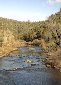
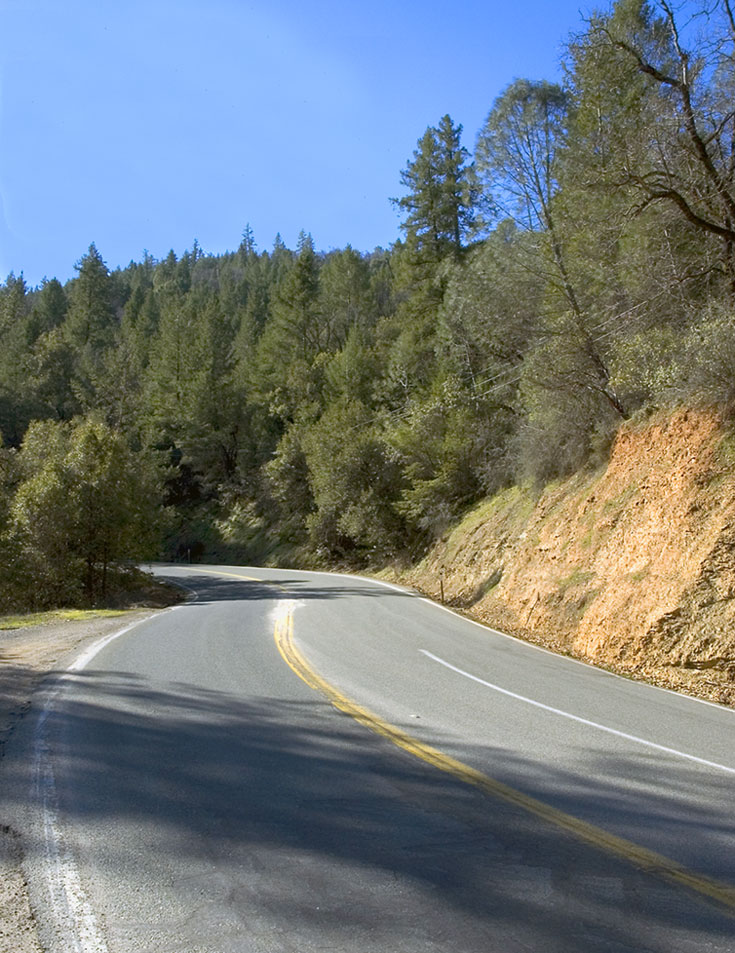
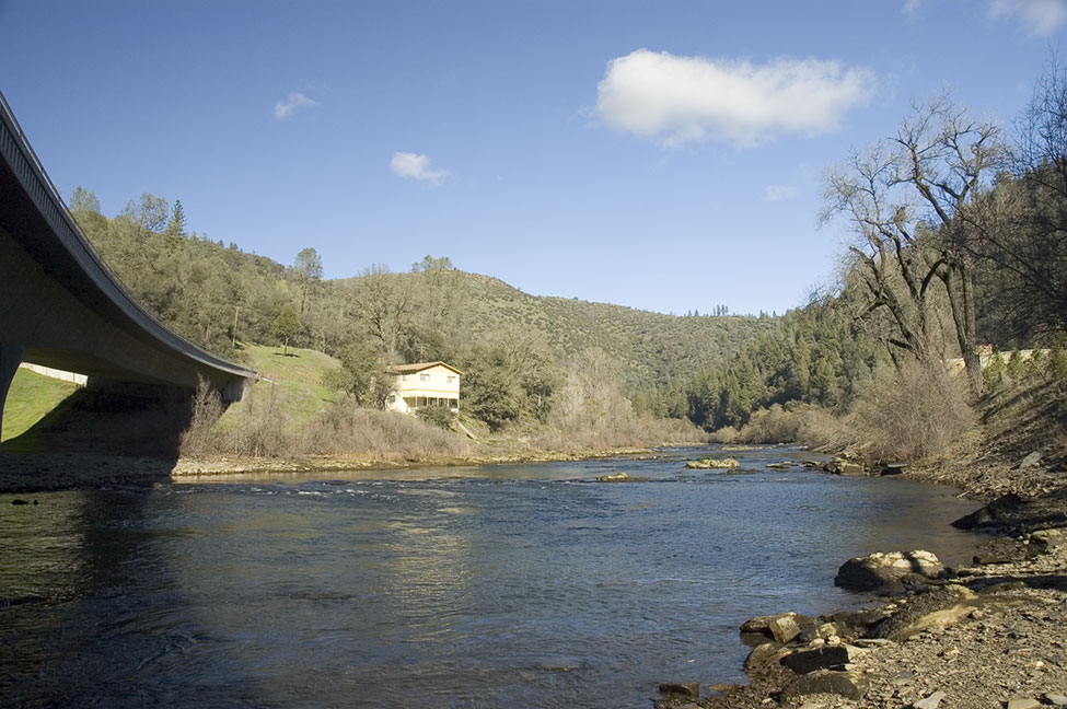
Route 193 drops from the ridgeline in Placerville into the valley of the South Fork of the American River. As you’d expect from an 11% road, there are plenty of curves in the descent. It was great to roll through those curves (M, L, XL), enjoying the sense of freedom that comes from riding a motorcycle. The air temperature dropped as I got closer to the river valley and, just before going over the river, I stopped to enjoy the scenery and take a few pictures (M, L, XL).
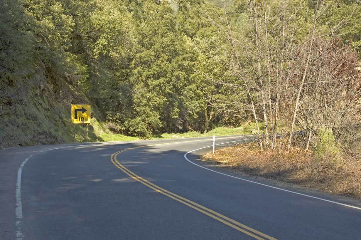
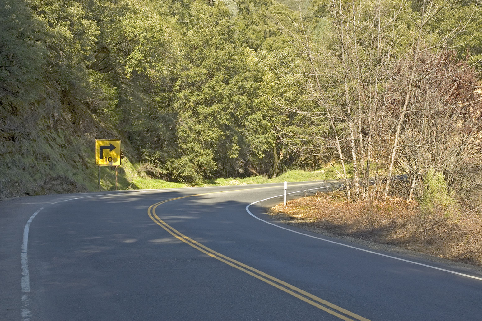
Common sense tells us that if there is a steep drop into the valley, there’s going to be a steep climb out of the valley. And that’s how I came across this sign. This sign, too, was a “first” for me – a 10 MPH sign around a curve (M, L, XL). As you approach the curve, the uphill side of the road is out of sight around a blind hairpin corner and so I had no problem slowing down and taking the corner at a sensible speed
Mind you, this is just one of the many sharp curves that lead from the river basin up the walls of the valley.
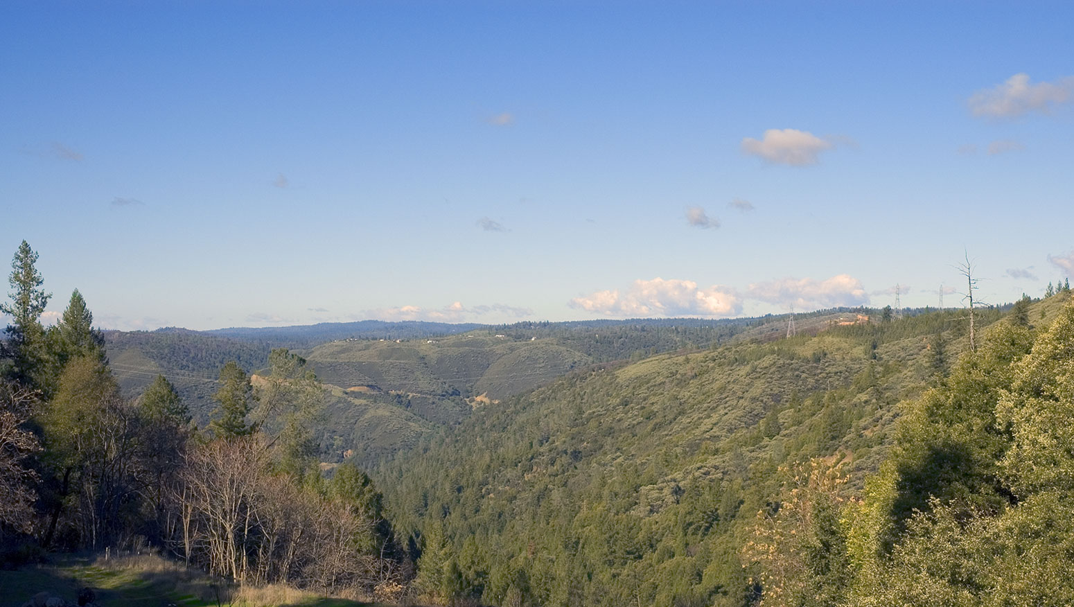
Once you climb out of the valley, the road flattens out but there are serious curves as the road snakes its way toward Georgetown. About 3/4 of the way up the hill, I found myself behind a semi pulling a backhoe on a long bed trailer. Fortunately, the driver was a Good Samaritan and he pulled into one of the turnouts to allow the accumulated traffic to pass.
The ride to Georgetown is easy to navigate and leads you right into the center of the downtown area. Turning right at the stop sign takes you along Main Street in Georgetown and it’s best traveled slowly. This is a small country town, with pleasant stores and a couple of places for a hungry rider to pull over and eat.
I had a great meal at the Gaslight Saloon (4119 Wentworth Springs Road) where $8.50 bought a plate brimming with refried beans, good Spanish rice, and a burrito that was filled with tender beef chunks. The meal was warm and filling and on par with food that I had when I lived in Santa Fe. Make sure that you stop in.
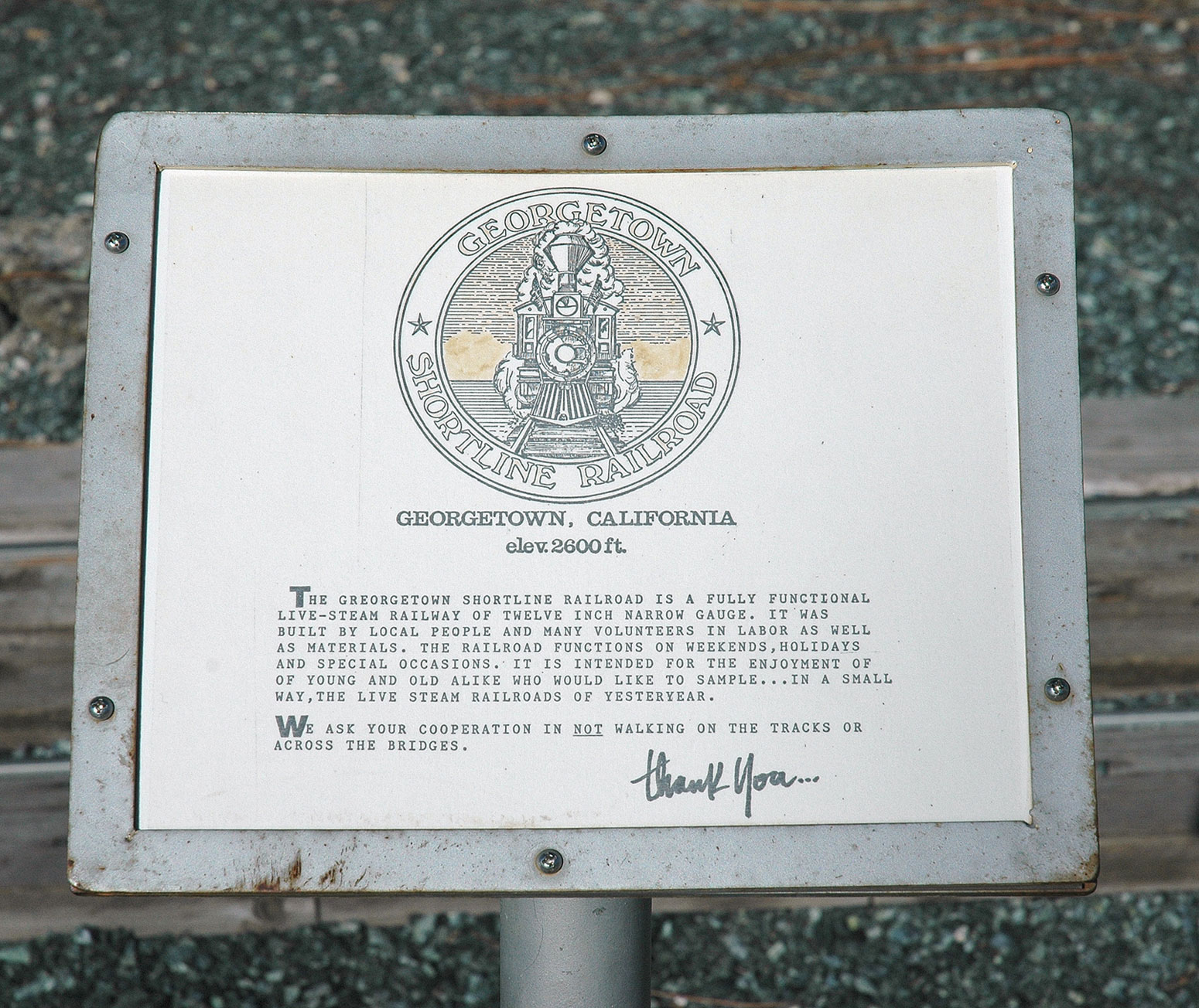
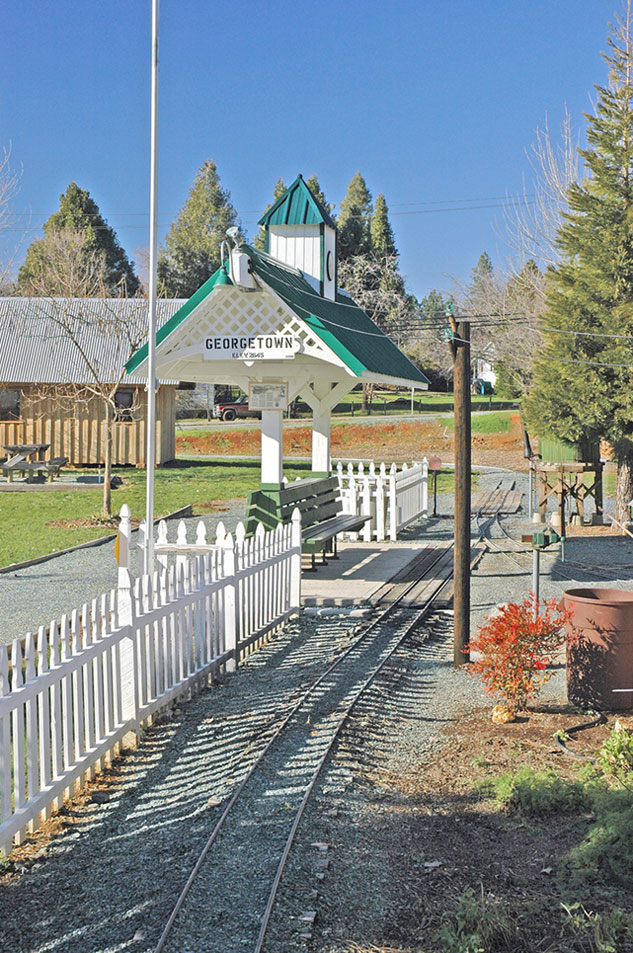
As you leave town, you’ll pass the Georgetown railroad (M, L, XL), a train with a fully functional steam engine running on a 12" wide track (M, L, XL). This is a high quality reproduction of a railroad line so it deserves some attention but make sure you don’t get too intrigued. I never even saw the sign that asks you not to walk on the tracks.
Once I’d checked out the railroad it was time to get going to Volcanoville so I headed NE out of town on Main Street. Main Street turns into Wentworth Springs Road, a two-lane road that runs through the forests of the Sierra Foothills.
It’s a short ride but a pleasant one — the run from Georgetown through Buckeye to Chiquita is very quick so it’s just a few minutes before you’ll see the sign for Volcanoville Rd on your left. (According to MapSource, it’s 8.2 miles from the intersection of 193 and Wentworth Springs Road to the Volcanoville Road turn off.)
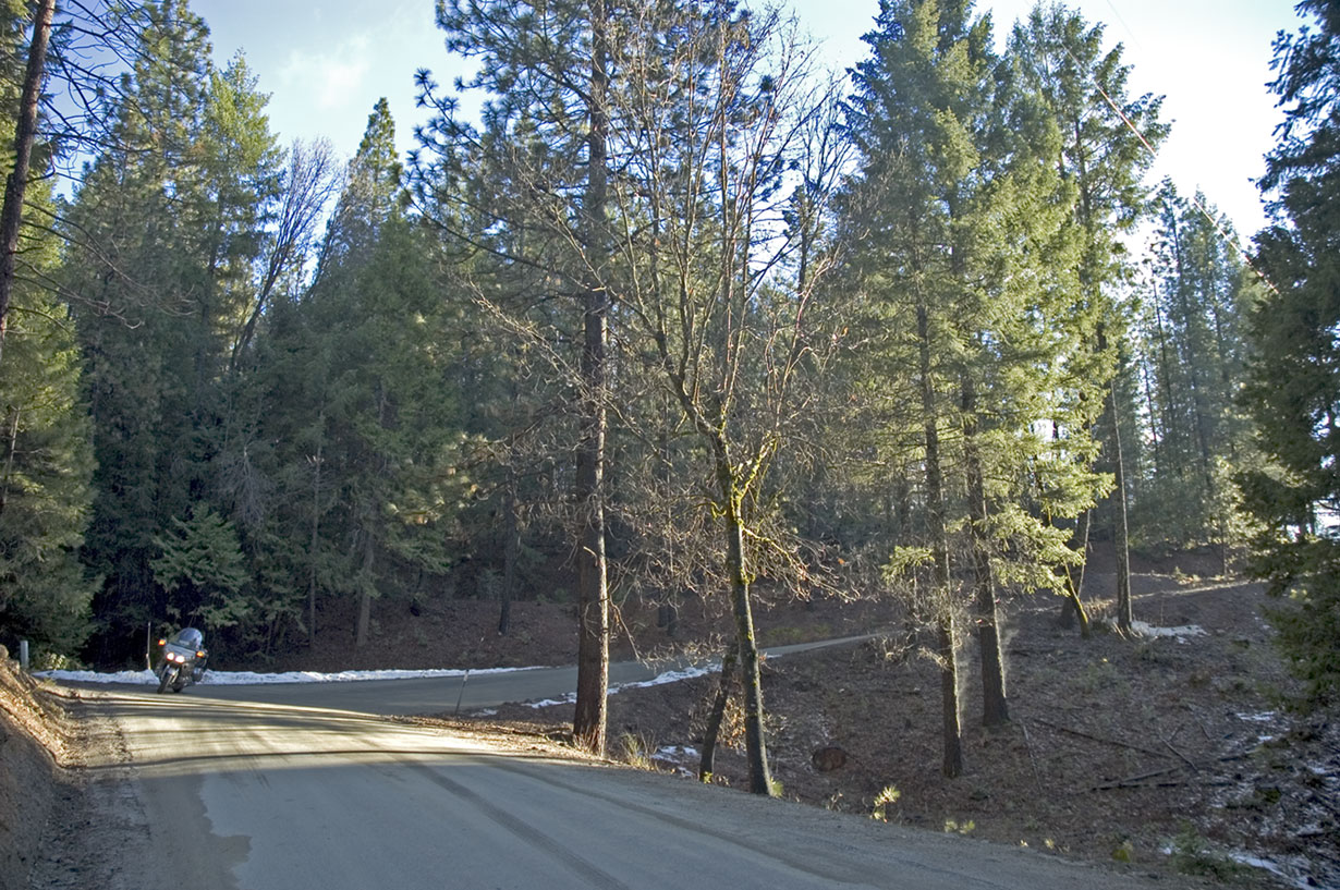
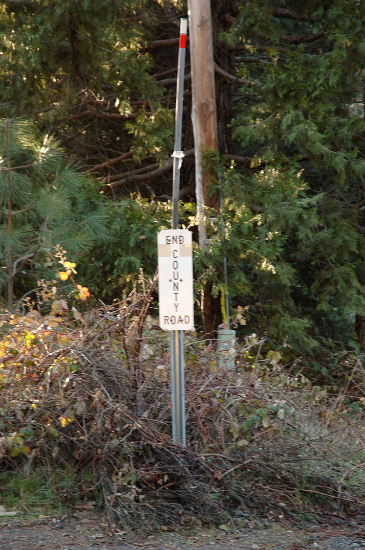
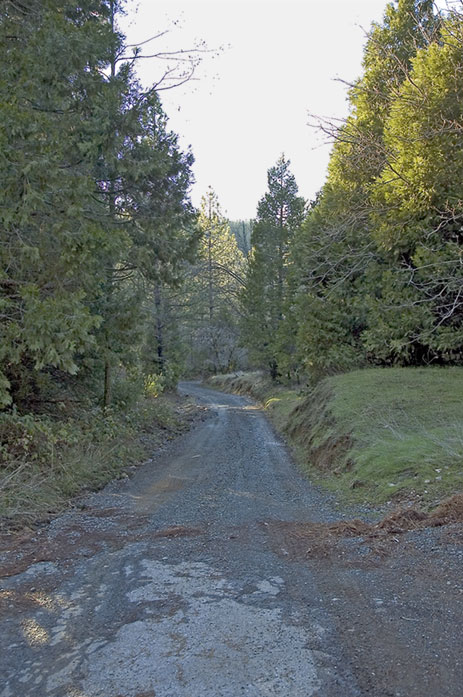
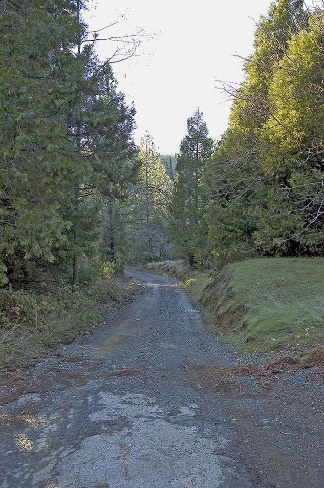
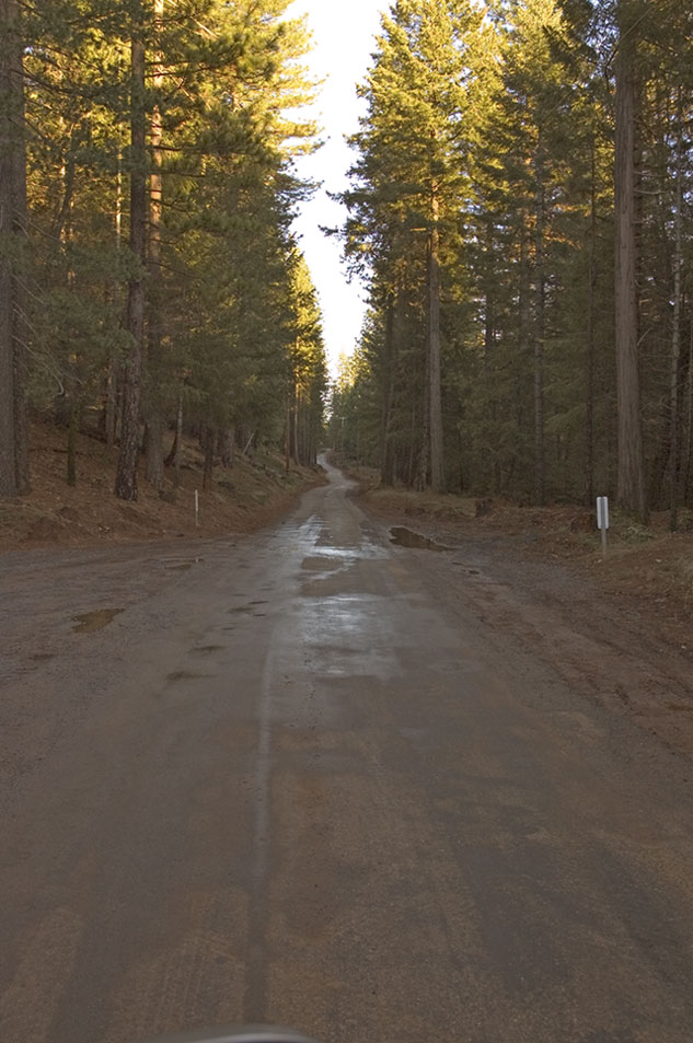
The paved road winds through the forest for few miles (M, L, XL) before you encounter the “End County Maintenance” sign (M, L, XL). The road starts out pretty well (M, L, XL) but then asphalt gives way to gravel for a few hundred yards and then it becomes a two-lane dirt road.
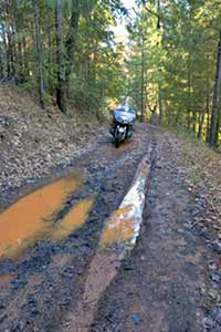
Create this mental image — a two-lane dirt road, a few weeks of rain, a 2003 Honda Gold Wing (almost 900 pounds with fuel), and street tires. When you add that all up, you have “an opportunity to excel”.
The first few hundred yards after the asphalt ended were okay. The road was gravel and very trafficable but I still took is nice and slow.
Once the gravel road changed to a dirt road, I could feel the read end of the Wing start to wiggle a bit. That is not a good feeling. I got on the left track of the road since that was the uphill side, thinking that the uphill side would be drier than the downhill side. Looking back, I don’t think that it made any difference.
I made it maybe a mile further before I called it quits.
For most of the way, I had to balance the Wing and finesse the throttle and clutch to stay upright, and there were a couple times when I needed all of my appreciable body mass and all of my strength to stay wheels down.
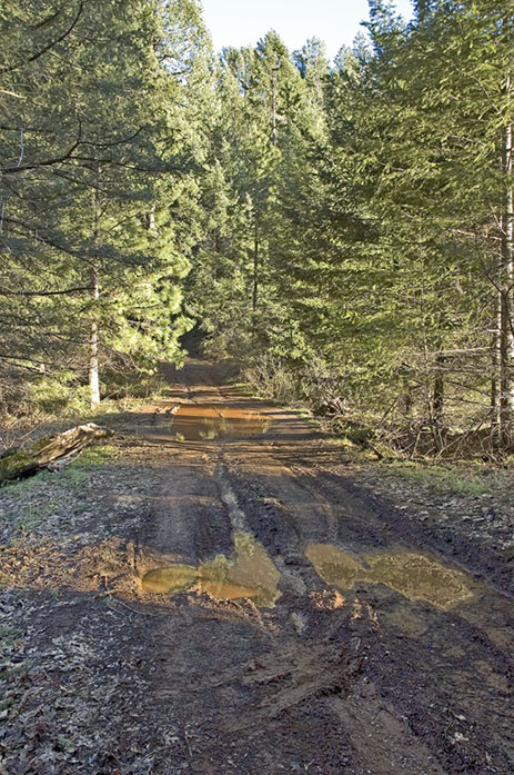
When I hit this obstacle (M, L, XL) , I found a path around the puddles in the background that you can see on the right side of the picture. The real “seat sucking moment” came when I had to put the Wing through the smaller puddles in the foreground. The rear end started sliding but managed to stay upright. I ended up needing to use reverse to get back on the road.
I didn’t use reverse just because it was the easy way to do it — despite my 250 lbs. of heft and decent leg muscles, the Wing would have continued forward over the edge if I hadn’t been able to use reverse.
I paused for a moment after that mini-adventure and analyzed the situation. Foremost in my thoughts was that Volcanoville has been deserted for many decades so I wouldn’t miss anything if I didn’t make it there that afternoon. On the other hand, I had just almost down the side of the road embankment. If I had been injured and couldn’t walk out, I could die of exposure. My decision was to turn back if I hit standing water again.
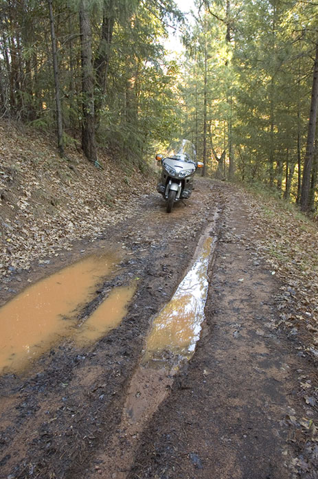
Sure enough, there were a couple of puddles about 100 yards down the road (M, L, XL) and than meant the end of the adventure. I dismounted, shot some pictures, then saddled up and reversed my course through the puddles and uphill along the muddy road.
The uphill ride proved to be less difficult than I had imagined. Even though I had just had my first experience of mud riding, I was surprisingly comfortable heading back along the road. There were no surprises as I headed back up the hill and made it to the gravel road.
Once I hit asphalt again, I stopped to take a few pictures (M, L, XL) and enjoy the quiet of the forest. A few homes were visible from the road but no traffic in the time that I was there.
The trip back to Placerville included a sunset view of the river canyon. The downhill into the canyon and the climb back out were fun. I enjoyed the curves once again. Once into Placerville, I turned right onto route 50 and enjoyed the ride home in the twilight.
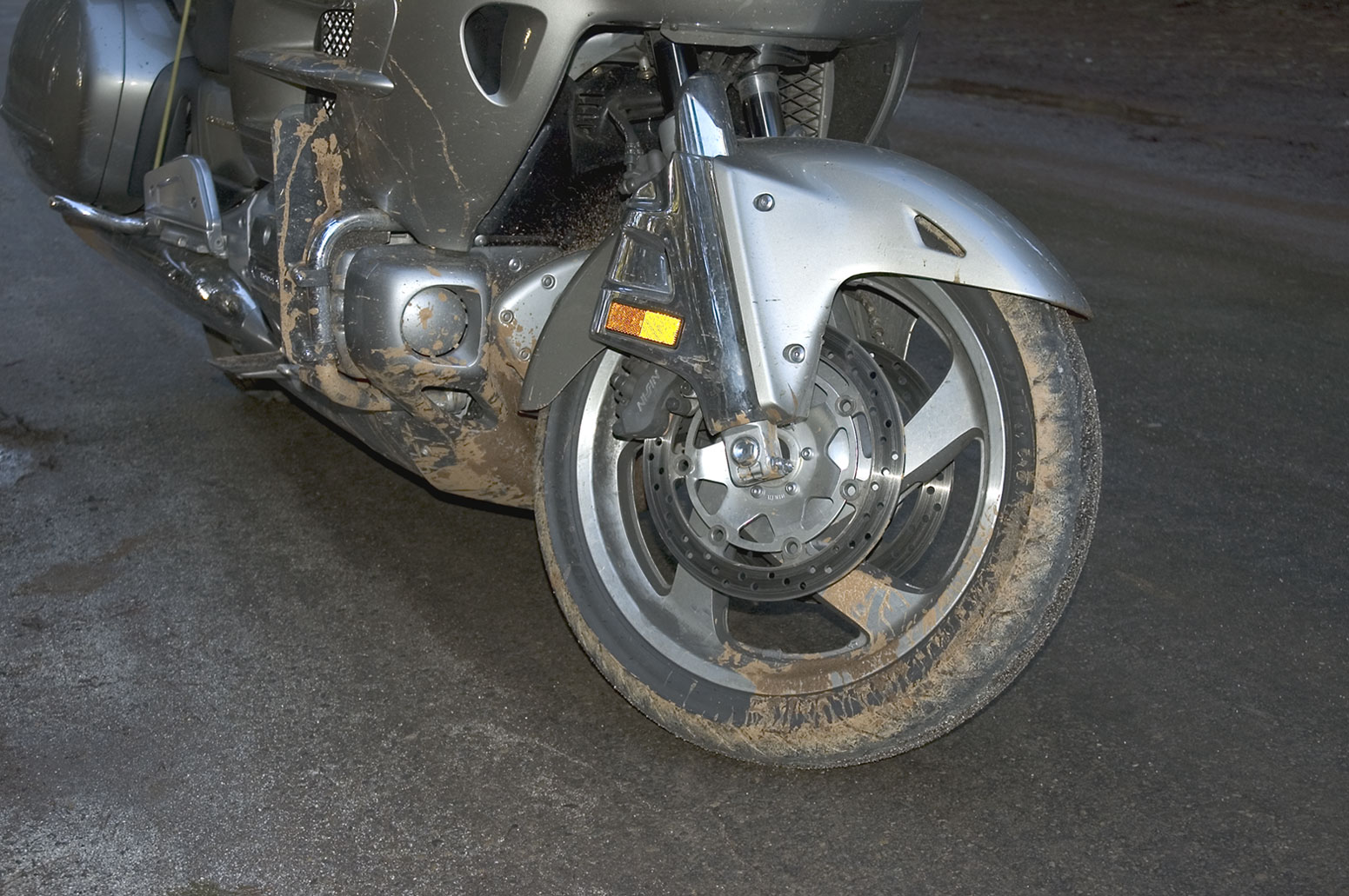
Looking back on the day, I had a decent ride, some good food, and even managed to get mud on a Gold Wing (M, L, XL) — all in all, a decent adventure!